The new digital map, in development for over two years, will help facilitate deployment of autonomous vehicles in Canada’s largest city
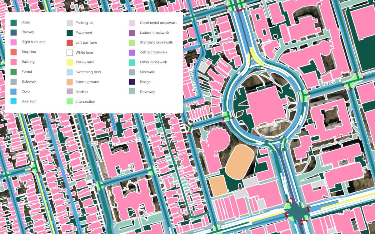
To create the map Ecopia gathered high-resolution street views and aerial images—these captured road networks with lane delineation, pedestrian features and buildings in 3D. There are more than 300 types of road signs in Toronto and over 330,000 individual road signs on the map. Photo: Ecopia AI
The new digital map, in development for over two years, will help facilitate deployment of autonomous vehicles in Canada’s largest city
Editor’s note: This article was updated to include statements from the City of Toronto sent after publication.
Ecopia AI, an Ontario-based leader in digital mapping, has built a high-precision, digital 3D map of Toronto for the use of autonomous vehicle(AV) development.
Two years ago, Ecopia received almost $1 million from the Ontario Vehicle Innovation Network (OVIN) to fund this map’s development. The work was done using artificial intelligence technology to plot crucial information about Toronto’s land cover and transportation features. The data is essential to supporting safe and effective AV transportation and navigation.
Ecopia also invested $2 million of its money into the project.
“AVs require various geospatial technologies to operate effectively and safely, including a foundational reference dataset of real-world features,” wrote a spokesperson for Ecopia AI in an email statement to Electric Autonomy.
“AVs cannot use open-source data or publicly available navigation maps as they are not created using consistent data specifications, which creates issues of completeness, accuracy and currency.”
To create the map, Ecopia gathered high-resolution street views and aerial images of road networks. The detail encompasses lane delineation, pedestrian features and buildings in 3D.
“These [details] are essential for training, testing and deploying AVs as they show where the vehicle can go and what it should avoid,” says the spokesperson.
One example of the precision involved: there are more than 300 types of road signs in Toronto and over 330,000 individual road signs on the map.
“This mapping data provided by Ecopia is a digital source of truth for the real world, which will act as a base layer to build smart city solutions on top,” says the spokesperson.
“This will enable those innovating in the AV space to operate off of a consistent foundational dataset and streamline the ability to collaborate.”
Licensing the digital map
Ecopia’s digital map of Toronto is now available for the city, manufacturers, regulators and other agencies to license.
(Ecopia currently works with other institutions and organizations on similar initiatives. These include the Canadian government, Chicago Metropolitan Agency for Planning and the World Bank.)
“We just completed this map and it is now in post-delivery testing with the city,” says the spokesperson.
“We won’t be able to disclose the users, even in the future, for confidentiality reasons as part of the contract. The project’s objective is that it be leveraged by a variety of public and private enterprises to advance the deployment of AVs.”
But the data obtained from the digital map of Toronto also has various other applications, says Ecopia. These scenarios include public safety, stormwater management and planning for sustainable infrastructure.
Toronto’s AV-ready status
In 2019, the Toronto City Council approved the Automated Vehicles Tactical Plan.
The strategy addressed how the city should prepare for AVs and influence the technology’s trajectory during its early phases.
“Since the approval of the AV Tactical Plan the City has completed or made significant progress on several key projects and initiatives,” wrote Russell Baker, manager of media relations and issues management at the City of Toronto, in an email to Electric Autonomy.
Some of the strides made towards making the city “AV-ready,” says Baker, include:
- Establishing the Transportation Innovation Zone at Toronto’s Exhibition Place, for trials for automated vehicles and other emerging transportation technology;
- Conducting three Transportation Innovation Challenges to test various technologies:
- Automated snow clearing devices for sidewalks (2021)
- Demonstrated “sidewalk robots” for a range of use cases (2022)
- Trialled automated parking and curbside management sensors (2023);
- Partnering with the Toronto Transit Commission (TTC) and Metrolinx for the West Rouge Automated Shuttle Trial in 2021;
- Utilizing the city’s Chief Information Security Officer intake to assess cybersecurity and privacy protection for various technologies, including AVs;
- Releasing the Guidelines for Submitting a Work Zone and Law Enforcement Interaction Plan for companies operating AVs;
- Integrating advanced driver assistance systems in selected fleet services vehicles; and
- Collaborating with the University of Toronto to research the impacts of “Zero Occupancy Vehicles” and integrating them in transportation modelling.
“Collectively, these efforts have greatly enhanced our comprehension of and readiness for automated vehicles in Toronto,” says Baker.